Kilimanjaro Route Comparison ,Summit Successful Rate
Compare Kilimanjaro routes by summit success rate, altitude, elevation, vegetation, weather, and difficulty levels.
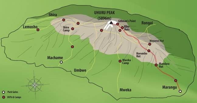
Mount Kilimanjaro offers several distinct trekking routes, each with unique scenery, altitude profiles, vegetation zones, weather patterns, and summit success rates. Choosing the right route is one of the most important decisions for a successful climb to Uhuru Peak. At Climb2Kili Adventures, we help climbers match the best route with their experience level, fitness, acclimatization needs, and travel goals. Some routes focus on scenic wilderness and gradual elevation gain, while others prioritize shorter itineraries or hut accommodation. Understanding these differences can dramatically improve your Kilimanjaro experience.
Kilimanjaro Route Comparison Overview
Summit Success Rates Explained
Northern Circuit
The highest summit success rate thanks to excellent acclimatization pacing.
- Longest route
- Low crowd levels
- Gradual altitude gain
Lemosho Route
Premium scenic route with strong success rates and beautiful landscapes.
- Excellent acclimatization
- Diverse scenery
- Popular premium choice
Machame Route
Adventure-focused route with dramatic terrain and strong summit potential.
- Barranco Wall
- Camping experience
- Great scenery
Umbwe Route
Steep direct ascent recommended only for experienced trekkers.
- Rapid altitude gain
- Low acclimatization time
- Physically demanding
Summit success on Kilimanjaro depends heavily on acclimatization. Routes with more days allow the body to adapt gradually to altitude changes, reducing the risk of Acute Mountain Sickness (AMS). Northern Circuit and Lemosho Route consistently produce the highest summit success rates because they combine gradual elevation gain with longer trekking schedules. Shorter itineraries like Marangu 5-day or Umbwe increase the chances of altitude-related difficulties because climbers ascend too quickly.
Altitude and Elevation Profiles
| Location | Elevation | Importance |
|---|---|---|
| Moshi | 890 m | Main climbing base town |
| Machame Camp | 3,000 m | Early acclimatization zone |
| Barranco Camp | 3,960 m | Key acclimatization stage |
| Lava Tower | 4,630 m | High-altitude adaptation point |
| Stella Point | 5,756 m | Crater rim approach |
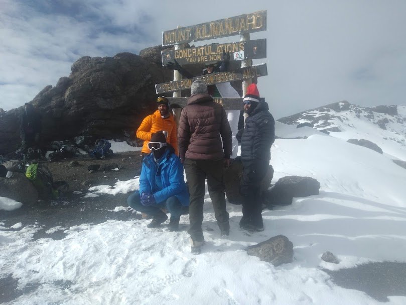
| Uhuru Peak | 5,895 m | Highest point in Africa |
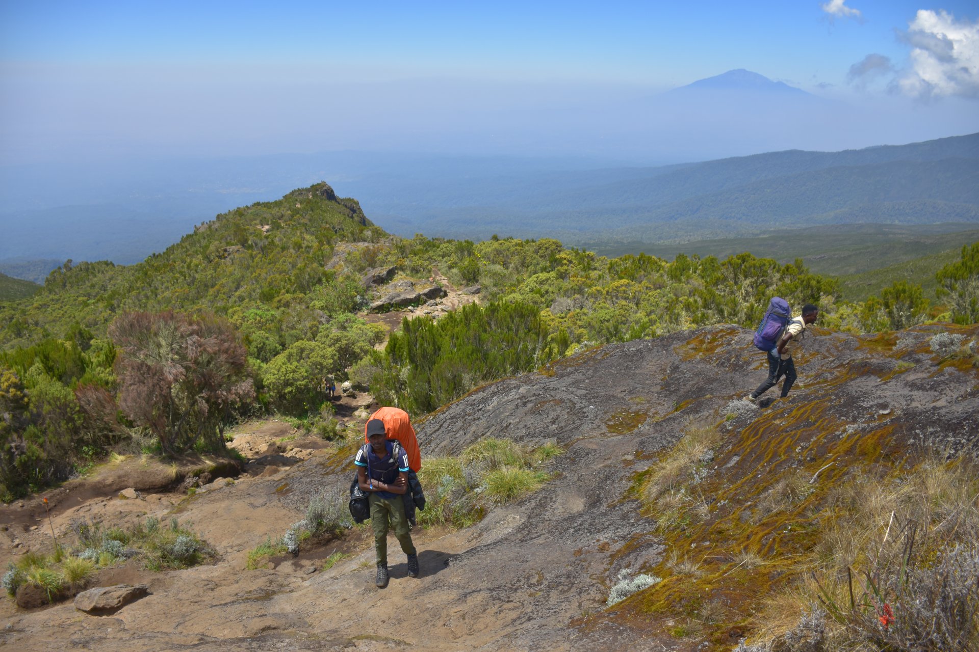
Mount Kilimanjaro rises from tropical farmland near Moshi to the frozen summit glaciers of Uhuru Peak at 5,895 meters above sea level. Climbers pass through multiple climate and vegetation zones during the ascent. Altitude affects every climber differently. Even strong hikers can experience headaches, nausea, fatigue, or shortness of breath at high elevation. This is why route design matters so much. Longer routes provide more time for adaptation, improving both comfort and summit performance.
Vegetation Zones on Kilimanjaro
One of Kilimanjaro’s greatest attractions is the incredible environmental transition from tropical rainforest to arctic summit conditions within just a few days. Machame and Lemosho are especially famous for showcasing all vegetation zones dramatically. The rainforest section often receives heavy rainfall, especially during April, May, and November. Higher alpine sections become increasingly cold and dry, with summit temperatures dropping well below freezing near Stella Point and Uhuru Peak.
Kilimanjaro Weather by Route
Machame & Lemosho
Wet rainforest starts but excellent dry-season visibility higher up.
- Best June-October
- Dramatic scenery
- Can be muddy lower down
Rongai Route
Northern side receives less rainfall throughout the year.
- Good during short rains
- Drier conditions
- Quieter trail
Marangu Route
Comfortable huts protect climbers during wet weather.
- Dormitory accommodation
- Popular with beginners
- Busy during peak season
Summit Conditions
Cold nights and strong winds are possible year-round.
- -15°C possible
- Wind chill common
- Layering essential
Which Kilimanjaro Route Should You Choose?
Choose Lemosho
Best for scenery, acclimatization, and premium trekking experience.
Choose Machame
Best balance of adventure, value, and summit success.
Choose Rongai
Best for quieter trails and drier conditions.
Choose Northern Circuit
Best overall summit success and remote wilderness.
Every Kilimanjaro route offers a different experience. Climbers seeking maximum summit success often prefer Northern Circuit or Lemosho Route because of their gradual acclimatization profiles. Travelers wanting a classic adventurous climb frequently choose Machame Route for its dramatic scenery and iconic Barranco Wall. Rongai Route works especially well during wetter months because it approaches Kilimanjaro from the drier northern side. Meanwhile, Marangu remains attractive for travelers who prefer hut accommodation instead of mountain camping. The best route is ultimately the one that matches your pace, fitness, altitude tolerance, and adventure style.
Frequently Asked Questions
FAQ search
Answers without the scroll
Northern Circuit has the highest summit success rate because of its long acclimatization schedule.
Umbwe Route is considered the most difficult because of its steep ascent and rapid altitude gain.
Lemosho and Machame are excellent beginner-friendly routes when climbed over 7-8 days.
Uhuru Peak stands at 5,895 meters above sea level.
Lemosho Route is widely considered the most scenic route on Kilimanjaro.
Yes. Rongai is generally drier, while Machame and Lemosho receive more rainfall in rainforest sections.
Find Your Perfect Kilimanjaro Route
Climb2Kili Adventures helps you choose the ideal route, season, and itinerary for a successful summit.
Talk to Our Experts